
Hiking Trails and Nature
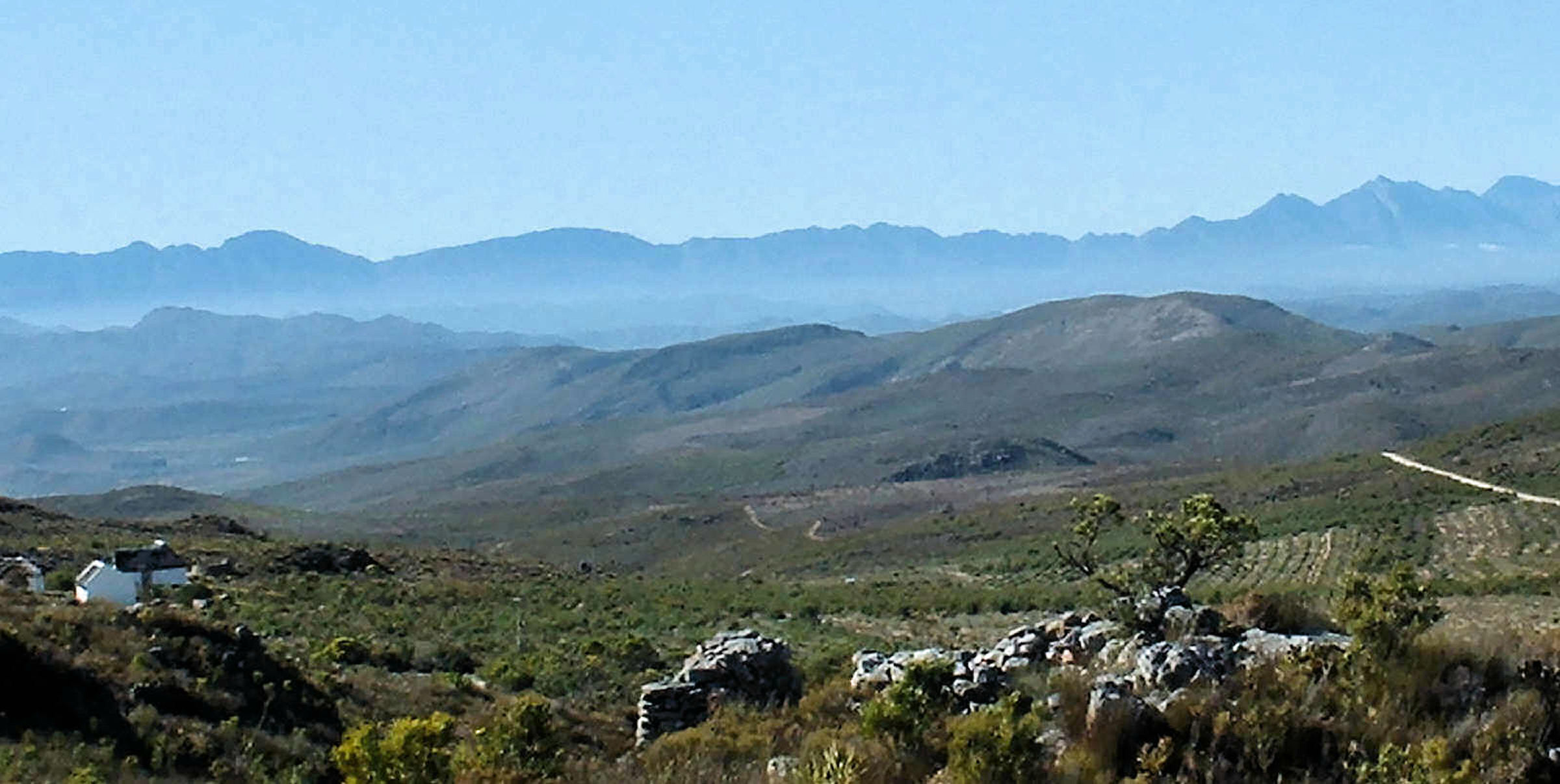
McGregor & Mountain Trails
- Boesmanskloof Trail (McGregor to Greyton) (Map Link)
- Start Point: Die Galg (14km south of McGregor)
- Distance / Duration: 14km one-way (approx. 5–7 hours) / Option for 28km out-and-back
- Difficulty: Moderate to Strenuous
- Highlights: Crosses the Riviersonderend Mountains, Oakes Falls, deep mountain rock pools, and mountain fynbos.
- Permits & Booking: Required via CapeNature (Vrolijkheid Office / CapeNature Central Reservations).
- Boesmanskloof Trail (McGregor to Greyton) (Map Link)
▶ Read More
Boesmanskloof Trail: Crossing the Riviersonderend Wilderness
Connecting the quaint village of McGregor in the north to Greyton in the south, the 14km Boesmanskloof Trail cuts through the heart of the Riviersonderend Conservation Area. This protected mountain catchment spans state land and private nature preserves, offering a wild passage across rugged, water-carved sandstone peaks that divide the arid Robertson Karoo from the lush valleys below.
Geology & Landscape
The path continuously ascends, descends, and contours along the steep, dramatic gorges of Boesmanskloof. Ancient geological forces have sculptured deep ravines where mountain streams feed refreshing, crystal-clear rock pools and tumble over precipitous drops, most notably at the famous Oakes Falls. Emerging from either end of the pass reveals sweeping, panoramic views of the fertile Greyton and McGregor agricultural valleys.
Flora & Botanical Wealth
As a stronghold of Cape Floral Kingdom biodiversity, the surrounding slopes are carpeted in vibrant mountain fynbos. Hikers tread among diverse Protea and delicate Erica species, alongside brilliant yellow Leucadendron (conebushes). Down in the damp riverbeds and along watercourses, indigenous wild almond trees flourish, providing shade and stabilizing the ravine banks.
Fauna & Wildlife Sightings
The rugged terrain supports a resilient animal community. Agile klipspringers navigate the cliff faces, while duiker, grey rhebuck, dassies, and chacma baboons inhabit the valleys. Elusive nocturnal predators like the spotted genet and the apex, secretive Cape leopard also call these mountain folds home. Avian life is equally rich: look for the brilliant flash of malachite sunbirds and Cape sugarbirds feeding on protea nectar, while black eagles and booted eagles ride the thermal updrafts overhead.
Route Logistics & Practical Information
Physically, the trek demands a reasonable degree of fitness due to the continuous gradient changes and uneven mountain paths. While the 14km single-day traverse requires pre-arranged transport between trailheads, many hikers opt for a 28km two-day out-and-back trek. The northern trail begins at Die Galg, roughly 14km south of McGregor, while the southern end terminates just outside Greyton.
Weather conditions fluctuate significantly throughout the year. This region experiences wet, cold winters, whereas summer months bring intense heat and dry landscapes, making a generous supply of drinking water essential during warmer periods. Overnight options are plentiful at both ends of the trail—including private facilities at Die Galg, local guesthouses, and a municipal campsite in Greyton—though wild camping along the path itself is strictly prohibited. Trail permits and general inquiries are managed via CapeNature (0861 227 362 8873), Vrolijkheid Nature Reserve (023 625 1621), or the McGregor Tourism Bureau (023 625 1954).
- The Kleinberg Trail (Badge Hill Walk) (Map Link)
- Start Point: Old Robertson dirt road (just past the brick works outside McGregor village)
- Distance / Duration: Approx. 2–3 hours circular
- Difficulty: Easy to Moderate
- Highlights: Gentle climb up Badge Hill displaying the iconic McGregor village crest, offering views over the valley.
- Permits: Available at McGregor Tourism Bureau.
- The Kleinberg Trail (Badge Hill Walk) (Map Link)
▶ Read More
The Kleinberg Trail: Panorama from Badge Hill
For a rewarding short hike right on the village doorstep, The Kleinberg Trail offers a two-hour excursion up the slopes of Badge Hill. Starting along the old Robertson dirt road near the old brickworks, the path climbs steadily through low-lying scrub and rocky outcroppings.
At the summit lies the famous painted McGregor crest, visible from the village below. The vantage point delivers panoramic views across McGregor, surrounding farmlands, and the distant mountain ranges. Accessible directly by walking out from town, it requires no vehicle transport and offers an ideal morning or late afternoon outing.
- Krans Nature Reserve Trail (Map Link)
- Start Point: Edge of McGregor village commonage
- Distance / Duration: 1–2 hours
- Difficulty: Easy
- Highlights: Historic trail along river gorges and cliffside vantage points with unique botanical flora.
- Krans Nature Reserve Trail (Map Link)
▶ Read More
The Krans Nature Reserve: Geology, History, and Ecotones
Perched right on the edge of McGregor, the Krans Nature Reserve offers a fascinating glimpse into both human history and ecological transitions. Centuries before the village was established, early Iron and Stone Age migratory groups traversed these paths between the coastal plains and the Little Karoo, leaving behind stone artifacts and lithic flakes embedded in the landscape. Fossilized plant remains in the rock faces further testify to the ancient geological origins of the ridge.
Ecologically, the reserve serves as a distinct ecotone where mountain fynbos meets Succulent Karoo. Slopes feature mysterious heuweltjies—circular fertile earth mounds formed by ancient termite colonies. In spring, the rocky ground erupts into color with wild freesias, babiana, chincherinchees, and glowing yellow euphorbias. Hidden among the rocks is the rare, mouse-pollinated Protea humiflora, whose blossoms face downward toward the earth. Short, accessible footpaths starting from Smit, Van Reenen, and Voortrekker Streets lead to the 1951 municipal leiwater dam, providing sweeping views over the village and habitat for soaring fish eagles and wetland birdlife.
- Genadendal Hiking Trail (Map Link)
- Start Point: Historic Church Square, Genadendal
- Distance / Duration: 25km 2-day loop (approx. 7–8 hours per day)
- Difficulty: Strenuous
- Highlights: Steep climbs through the Riviersonderend Mountains, pristine mountain fynbos, rock pools, and panoramic views over the Overberg region.
- Permits & Booking: Required via the Genadendal Information Centre / CapeNature.
▶ Read More
Genadendal Hiking Trail: Overberg Vistas and Mission Heritage
Rich in both natural splendour and cultural heritage, the Genadendal Hiking Trail is a challenging 25.3km, two-day circular route. The trek begins at the historic Moravian Mission Church Square (established in 1738) before ascending into the high wilderness of the Riviersonderend range.
Day one climbs past the natural mountain pools of Groot and Klein Koffiegat, crossing dramatic ridgelines with sweeping views extending across the Overberg and the Worcester-Robertson Karoo. The route descends the northern slopes to overnight at Die Hoek Farm. Day two completes the loop back across the mountain to Genadendal. The steep terrain demands good fitness and preparation for changing mountain weather conditions. Trail permits are managed via CapeNature, with overnight farm accommodation booked separately.
- Kingsriver Kloof Trail (Map Link)
- Unfortunately, the current landowner does not permit access to this trail.
▶ Read More
Kingsriver Kloof Trail: Ancient Ravines and Archaeological Wonders
Carved over millions of years by flowing mountain waters, the ravine along the Kingsriver Kloof Trail offers a gentle yet immersive walk through deep natural history. Setting off from Kingsriver, the path weaves past water-eroded rock faces, cascades, and tranquil rock pools.
The cliffs house accessible overhangs and caves utilized by early San and Khoikhoi inhabitants. Archaeological finds along the riverbed include Early Stone Age hand axes, Later Stone Age lithics, and ancient clay potsherds. Monolithic rock walls shelter a rich array of wildlife; klipspringers and baboons navigate the crags, while Cape clawless otters inhabit the watercourses. Above, black eagles and fish eagles territorial calls echo across the gorge.
Vrolijkheid Nature Reserve Trails
▶ Read More
Vrolijkheid Nature Reserve: Succulent Karoo and Mountain Ridges
Situated roughly 5km outside McGregor on the road to Robertson, the Vrolijkheid Nature Reserve protects a dry, rugged landscape dominated by succulents, dwarf shrubs, and open Karoo plains framed by the Elandsberg Mountains.
For birding enthusiasts, the easy 3km Heron Trail leads across level terrain to two dams equipped with secluded bird hides. Over 195 bird species have been recorded here, making it a sanctuary for waterfowl and migrants. In contrast, the 19km circular Rooikat Trail is a strenuous, 8-hour trek across rough, arid ridges. Hikers on the Rooikat Trail are rewarded with expansive vistas of the Langeberg and Riviersonderend ranges, often spotting springbok grazing among the hardy Karoo vegetation. Self-issued day permits are available at the reserve office.
- Rooikat Trail (Map Link)
- Start Point: Vrolijkheid Nature Reserve Main Entrance (Robertson Road, McGregor)
- Distance / Duration: 19km circular (approx. 7–8 hours)
- Difficulty: Strenuous
- Highlights: Circles the Elandsberg Mountains with panorama views of the Langeberg range; succulent Karoo flora and game spotting.
- Permits: Day permits payable at Vrolijkheid Reserve main entrance or CapeNature.
- Agama Trail (Map Link)
- Start Point: Vrolijkheid Nature Reserve Office
- Distance / Duration: 9km (approx. 2.5–3 hours)
- Difficulty: Moderate
- Highlights: Follows jeep tracks to Island Dam for birdwatching before connecting with the lower Rooikat and Heron trails.
- Heron Trail & Braille Trail (Map Link)
- Start Point: Vrolijkheid Nature Reserve Visitor Center
- Distance / Duration: 3km circular (Heron) / 1km (Braille Trail) (approx. 1 hour)
- Difficulty: Easy / Wheelchair & visually impaired friendly
- Highlights: Two bird hides overlooking dams, tactile plant signage, and waterfowl viewing.
Robertson Valley & Farm Trails
- Van Loveren Fish Eagle Trail (Map Link)
- Start Point: Van Loveren Family Vineyards, R317 Robertson
- Distance / Duration: 7.5km – 8.5km (approx. 3 hours)
- Difficulty: Easy to Moderate
- Highlights: Winds along the Breede River bank and climbs the Rooikrans kopje overlooking vineyards and the Breede Valley.
- Permits: Obtainable at the Van Loveren tasting room.
- Dassieshoek Nature Reserve Trails (Map Link)
- Start Point: Foothills of the Langeberg Mountains, north of Robertson
- Distance / Duration: Day walks (varying 5km to 12km) and 2-day mountain hut routes
- Difficulty: Moderate to Strenuous
- Highlights: Mountain streams, protea-covered slopes, gorge crossings, and overnight hut options.
- Permits: Managed via Langeberg Municipality / Robertson Tourism.
- Fossil Hills Wine Walks (Map Link)
- Start Point: McGregor / Klipdrift area
- Distance / Duration: 10km – 13km daily (3-day guided wine-walking routes)
- Difficulty: Moderate
- Highlights: Guided walks connecting local wine estates, olive groves, and fossil-bearing rock formations.